Capilano River Regional Park & Cleveland Dam

Markus taking a break after going through the steps at Capilano River Regional Park
A couple of years ago, we wrote about one of our visits to Ambleside Park in North Vancouver. At the time, we mentioned how the Capilano-Pacific Trail, which is located right by Ambleside Beach, goes all the way up the Capilano River towards the Cleveland Dam. The entire Capilano-Pacific Trail (which is temporarily closed due to a landslide) is about 7.5km and takes about 2 hours to hike. It's one that we have yet to do, but when it is safe to, it might just be one that we'll end up doing.
For this week, we decided to start on the far end of the Capilano-Pacific Trail instead and check out the Capilano River Regional Park. The trail follows the Capilano River, past the Capilano Suspension Bridge and eventually meets with the Palisades Trail, which is a part of the Capilano River Regional Park (wow, we said Capilano a lot). The park itself is bookended by the Cleveland Dam, which is an impressive structure that you can even walk on top of!
About Capilano River Regional Park & the Cleveland Dam
Markus standing off to the side of the Cleveland Dam
Located just a little bit past the Capilano Suspension Bridge in North Vancouver, the Capilano River Regional Park is a large forest with steep paths and walls. This park is a destination for a lot of local hikers, campers and has limited access points to do some freshwater fishing along the river. Starting at the Cleveland Dam, the Capilano River runs all the way down, underneath the Capilano Suspension Bridge and into English Bay. The regional park consists of a combination of different trails which have been well-kept and maintained by the city. The man-made steps throughout the park keeps it relatively safe to hike.
Named after the engineer (Ernest Albert Cleveland), the Cleveland Dam is about 300 feet tall and holds back water from Capilano Lake, which provides drinking water for much of the Greater Vancouver region. If you're visiting the dam, we would recommend the option to walk on top of the dam or you can also take a set of stairs down to a viewpoint that sits off to the side of where the water is rushing out. Between the dam and the Salmon Hatchery (currently closed due to COVID-19), there are plenty of attractions to bring the family beyond hiking, camping or fishing and we'd recommend spending an afternoon here.
Our Preferred Route

Type: Park & Trail
Length: 3.0 km
Traffic: Moderate
Route Type: Multiple Trails/Loop
Your GPS might not necessarily take you to the right starting point, so be sure to read through this and double check that you're at the right spot. The road you want to take goes up along Capilano Rd. and the path eventually forks to the left just as it hits Mt. Crown Rd. You can only access this street while heading north and it's a little tucked in and can be tight if there are cars coming from the other way.
Once you're on this path, you'll want to keep going all the way down the road until you've hit the last parking lot at the end. Our hike and trailhead begins towards the end of Capilano Park Rd. where there will be ample parking for hikers and campers. You'll know it's the end because the road becomes a loop where you can do a u-turn and head back out.

Markus going up the steps on the Palisades Trail
This was a good place to start because it's close to the stairs that goes up towards Cleveland Dam right away, so if you're parking along the right side of the road, the trailhead (to Palisades Trail) is immediately next to it. Once you've started the hike, you'll be met with a series of stairs and a steep climb that'll take you up towards Cleveland Dam. This path will be sure to raise your heart rate a bit, so be prepared for that and wear something appropriate.
As you keep heading up on Palisades Trail, you'll eventually hit Service Rd., which is a path for vehicles and no longer a trail. Go left on that path and in a few minutes, you'll be at the base of the Cleveland Dam already. Spend some time around this area. There are viewpoints where you can view the rushing of water coming through the damn and down to the river below. It's a great place to stop for photos (although it's hard to get an angle that isn't partially blocked by the fence)!
When you're ready to keep going, you can go up the stairs that's located by the right side of the dam. At the top, you can walk across the top of the dam to get to the other side and continue the hike on the trail. It's worth taking a few moments to check out both sides of the dam from the top - on the one side is the big body of Capilano Lake and the other side is water rushing down, being controlled by the dam.

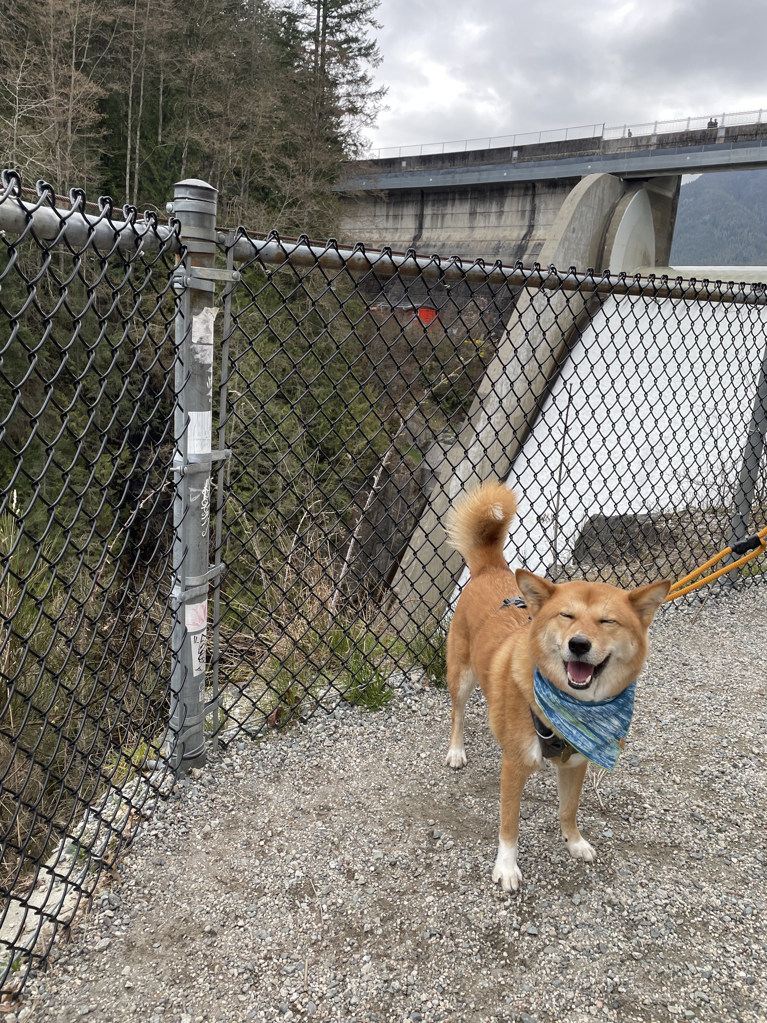
Markus choosing to go through the trail that requires a leash instead
We'll pick up the trail once you've gotten to the other side of the dam. On that end, there are a couple of trails you can take, but take a moment to figure out which one's right for you. If your dog is reactive or not great with dogs that are off-leash, we recommend taking the Baden-Powell Trail. Although this is the longer trail of the two, it is also the one that is leash-required.
We had actually started to go down the Capilano-Pacific Trail because it was shorter and it had started to drizzle while we were there, but quickly realized that there were too many off-leash dogs for our comfort. We quickly turned back to go down the Baden-Powell Trail instead where we did come across a number of dogs still, but the owners were very mindful to keep them at a distance. From what we could see from the distance, the Baden-Powell Trail had considerably fewer dogs than the other trail.
If you keep following the trail, it actually begins to get a little tricky. We recommend taking a photo of a map or having some sort of a GPS to keep you on track (although we found Google Maps to not be very accurate while we were in the park and the maps at the park were a little confusing as well). The Baden-Powell Trail eventually hits a fork where there are three paths, but the map only shows two. We took the one that went the man-made wooden steps. Just make sure that you're not taking the path towards Capilano-Pacific Trail because that'll take you to a much longer walk.

Photo of the map at Capilano River Regional Park. Yellow trails are the leash-required trails.
You basically want to make your way back on the other side of the Capilano River and there are really only two bridges that take you across. As of the time of this writing, it should be noted that one of the bridges (and its surrounding paths) are closed for renovations. The path that we ended up taking was slightly longer than the path that we would've taken during regular circumstances and it's also why we had to take the bridge along the Pipeline Trail towards the bottom of the park as opposed to the Cable Pool Bridge, which is towards the east side of the park and closer to the parking lot where we started.
As the only bridge available, you'll want to cross it to get to the other side of the bridge where we should normally be able to take the Coho Loop that'll take us back towards the parking lot. Since this trial was closed as well, we needed to keep going along the Pipeline Trail, which starts to go uphill, and then take the first left at the fork. If you take another left, the trail eventually meets up with the Coho Loop and back to the parking lot. It is also possible to walk along Capilano Park Rd. - the same road you used to make your way in - but if you have your dog with you, it's not as safe since it's immediately on the side of the road.
What we liked
The Cleveland Dam is a cool place to check out. It's neat to be on top of the damn to see the amount of water on one side and how it's controlled coming out the other side.
The park is a combination of a lot of trails where you can pick and choose with paths you want to take.
What we didn't like
We felt that the park wasn't very well marked and got turned around a couple of times. It should help to keep a photo of a map with you or an accurate GPS.
As mentioned, a lot of the usual paths are currently closed due to COVID and for renovations, so the paths are limited.
Our Recommendation for Reactive Dogs
All in all, the trails are wide and well-kept, so it's easy enough to recommend. If you're planning to do the full loop, it takes about an hour and if your dog is reactive, we would highly recommend taking the Baden-Powell Trail (leash-required trail) instead. We found the dog owners on that trail to be a lot more mindful to the fact that it is a leash-required trail and kept their dogs at a safe distance. On the other trail, we had trouble with off-leash dogs running far off from their owners and coming quickly towards our dog, which prompted us to take the other trail instead.
We had an issue at the top of the dam where a negligent dog owner had let their two dogs off-leash way too early and while we were still on the road well before the trailhead. The owner started their exercise and ran off with the two dogs not following and they proceeded to run at a few of the other on-leash dogs (including ours) who were clearly irritated, but the owner was already too far to know or care that any of this was happening. The owner eventually called out from a distance and the dogs took off to keep up. While it was a nuisance, we consider this a one-off issue.

Disclaimer
Markus is a reactive, but not aggressive dog. His instinct is to avoid other dogs and he may growl, bark or lunge if provoked, but will not attack. We normally do not have issues with leashed dogs when both sides are controlled, but we will be on guard when an oncoming dog is not leashed. There are varying levels to a dog’s reactivity and only you can decide if this park, trail or hotel is appropriate for your dog. Our visits generally will not include off-leash areas; most experiences shared on The Markus Project are within leashed or undefined areas.
Please remember that our past experience visiting a park, trail or hotel may not be the same as your experience at the same park, trail or hotel. We have no control of who visits the park and whether they adhere to park rules - like leashing their dogs on leash-required paths - or not. Please use your discretion with the information provided and with your personal knowledge of your dog’s reactivity when visiting these parks, trails or hotels.